Image List
-
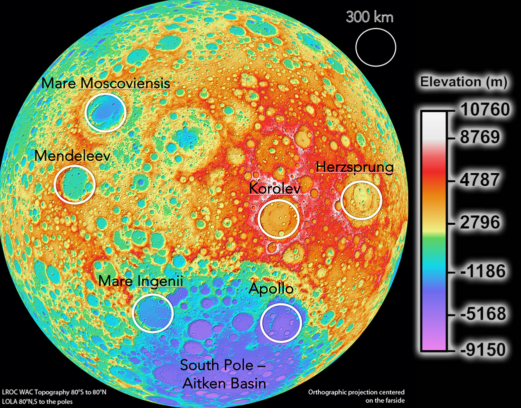
Taken by NASA's Lunar Reconnaissance Orbiter, this image of the moon is part of the collection of the highest resolution, near-global topographic maps of the moon ever created. Overlaid on this image are some of the hotspots identified for cosmology telescopes on the moon; few ideal locations for these telescopes exist on the moon, as others conflict with the radio quiet zone.
NASA/Goddard Space Flight Center/DLR/ASU; Overlay: M. Elvis, A. Krosilowski, T. Milligan -
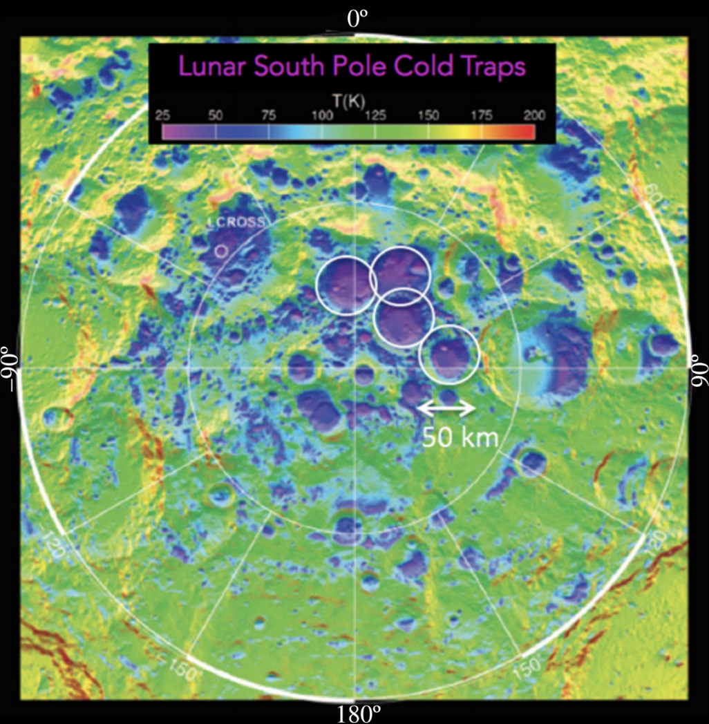
Lunar cold traps located at the South Pole of the moon, are critical to all moon-based operations because they contain frozen water molecules. Water is required for all moon-based operations because it is needed to grow food, and to break down into oxygen for breathing and hydrogen for fuel. The four white-circled regions in this image contain the coldest terrain with average annual near-surface temperatures of 25-50 K. They are about 50 km across.
David Paige, reproduced with permission.